
As meteorologists monitor current tropical activity, all eyes are focused on the Atlantic, where recent events signal an increase in storm activity.
While the Atlantic basin experienced a comparatively peaceful period earlier this year, experts caution that the season might swiftly worsen.
With the Saharan dust spreading, tropical activity is increasing, indicating a possible shift in weather patterns. The National Hurricane Center (NHC) is monitoring two disturbances in the Atlantic.
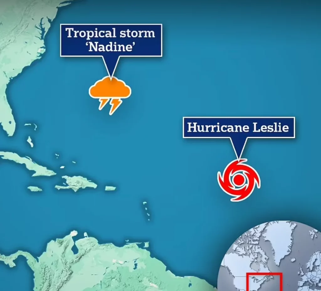
Hurricane Leslie is gaining strength and has already been elevated to a Category 1 hurricane with sustained winds of 85 mph.
It is located approximately 1,015 miles east-northeast of the Northern Leeward Islands and is slowly heading northwest at 10 mph.
Predictions say Leslie will strengthen further before weakening in the coming days. The present track indicates that it is headed toward Europe, with no immediate threat to the United States mainland.
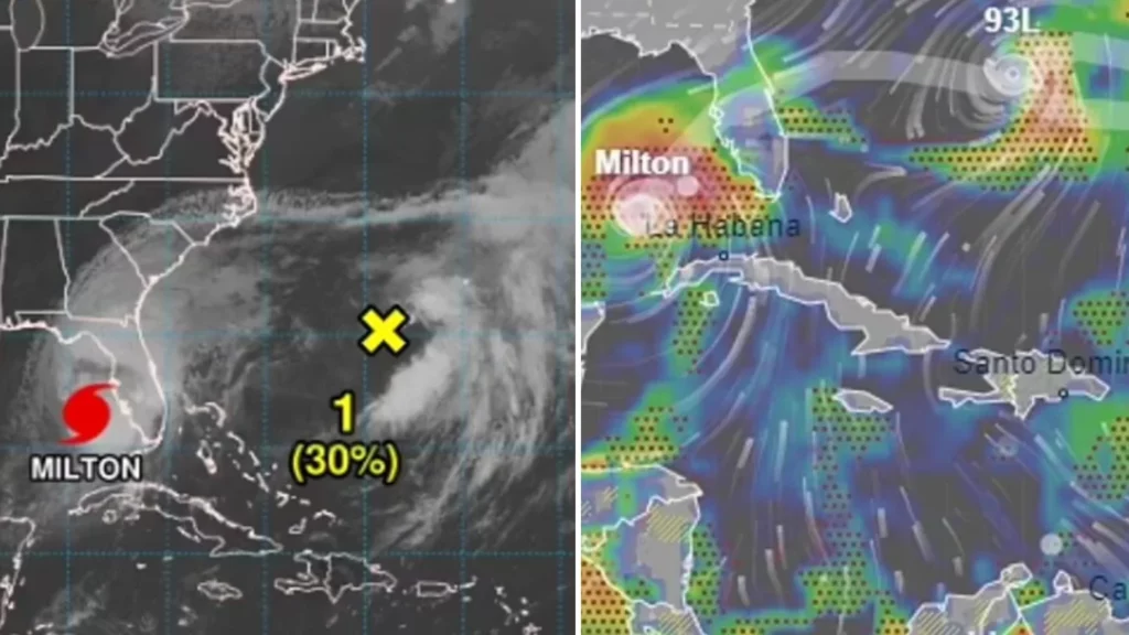
Meanwhile, another weather system is attracting attention. Invest 93L, a non-tropical low-pressure region, is located around 650 miles off Florida’s eastern coast.
According to the National Hurricane Center, this system is showing symptoms of becoming a more organized tropical storm.
If wind speeds improve, it might become Nadine, the 14th named storm of the 2024 Atlantic hurricane season.
Accuweather meteorologist Tom Kines stressed the importance of these events. “Of those three, Milton is by far the most dangerous and will be the most dangerous,” Kines said.
His statements speak to the trio of storms now operating in the Atlantic, emphasizing that, while Leslie and the possibility Nadine may not affect the United States, the threat is unpredictable.
“I don’t want to say it’s a zero percent chance,” Kines added, suggesting that the evolving conditions could still present surprises.
Despite the recent increase in tropical activity, experts caution residents not to become complacent.
Alex DaSilva, Accuweather’s lead hurricane analyst, warned of a “parade of storms” that may occur as the dry air dissipated.
“This dramatic increase in activity will begin at the end of August and continue through September,” he said, implying the likelihood of a surge similar to the record-breaking 2020 hurricane season.
Meteorologists are also following the aftermath of Hurricane Helene, which caused severe damage in Florida and North Carolina. With over 225 people killed, including 19 in Florida, and hundreds still missing, the region remains vulnerable.
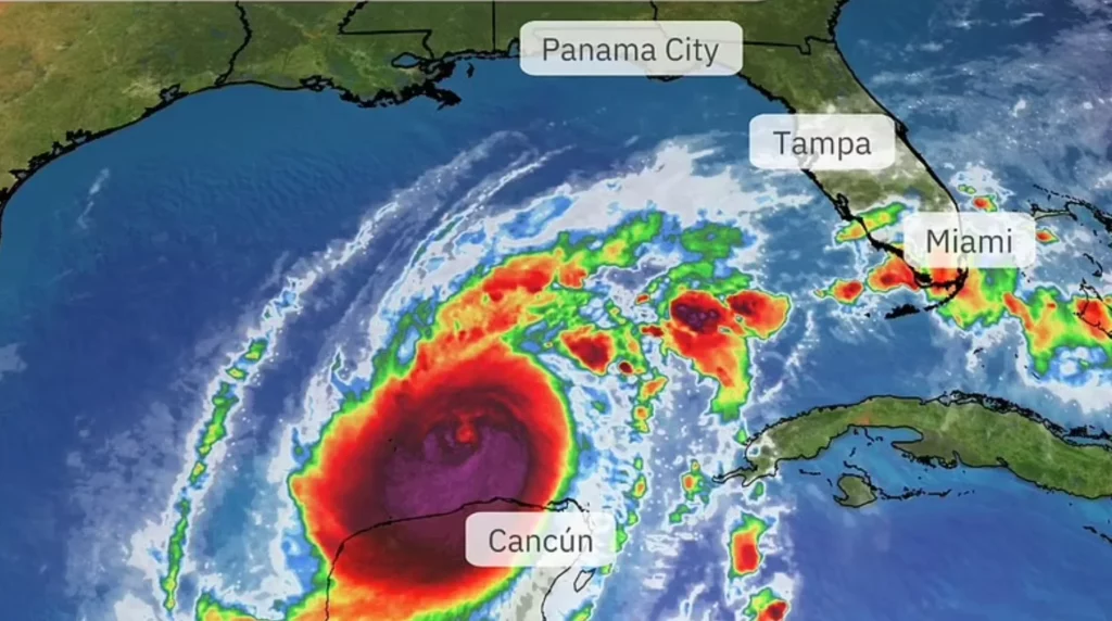
Florida State Climatologist David Zierden voiced fear that Helene’s remnants could intensify future storms, especially with Hurricane Milton on the horizon. Despite all of this, Hurricane Milton remains the most important threat.
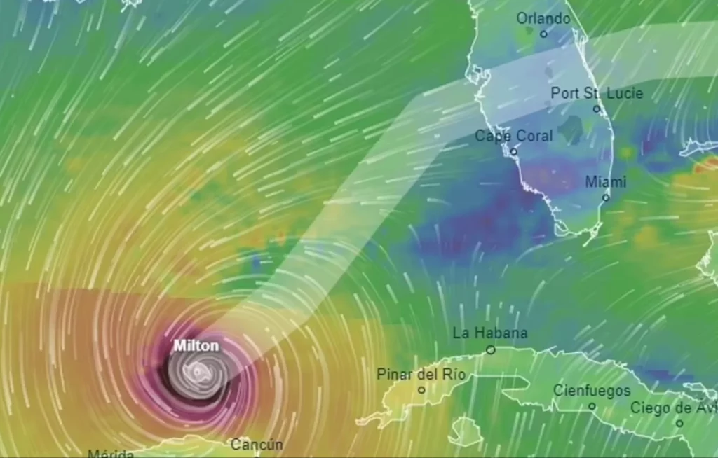
The storm is predicted to make landfall in Florida soon, with winds exceeding 155 mph and storm surges of 15 feet.

The National Hurricane Center has warned that Milton might become one of the most damaging hurricanes on record in Florida’s west-central region.
The state has begun its greatest evacuation campaign since Hurricane Irma, encouraging 5.5 million citizens to leave Florida’s west coast.
Despite the approaching threat, Kines and other researchers are closely monitoring the other systems building in the Atlantic.
The issue remains: will these systems worsen, or will they, like many others, fade before becoming a serious concern?
Feature Image Credit: (Weather.com)
